
Franklin Township Neighbor Records
Records about Franklin Township neighbors describe parcels, recorded parties, public civic geography, and historical listings. They do not combine into a current household roster. Start with the map to establish which lots are adjacent. Then use the assessor for assessment evidence and the County Clerk for a recorded instrument. A voter-list request has separate statutory and certification limits, while library directories describe an older published household.
| Block source | What it can show | Access path |
|---|---|---|
| Somerset GIS | Parcel shapes, shared lines, 200-foot tool, reports, and maps. | Public parcel viewer; owner names are redacted in parcel data. |
| Franklin TaxDataHub | Assessment property and owner-search dimensions by parcel. | Public search, subject to the displayed result cap. |
| County Clerk Acclaim | Recorded instruments, parties, legal descriptions, and dates. | Free account for images; Alpha Index for older material. |
| Voter file | Regulated public fields if lawfully supplied. | Somerset's specialized request form and its restrictions. |
| Library collections | Historic street-guide and directory entries. | Franklin library and regional local-history collections. |
An assessment owner or a deed party is not necessarily a current occupant. A separate mailing address can reflect an estate, trust, business, or a stale correspondence field. Keep the evidence label beside every result.
Map a Franklin Township Block
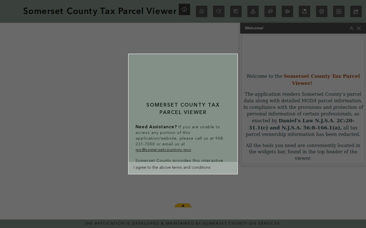
The Somerset County Tax Parcel Viewer is the local starting point for a block lookup. The county's 2024 announcement documents address, block/lot, and property-class searching, parcel selection, map or report generation, bookmarks, and 200-foot notification or search tools. It also states that current owner names are redacted from the tax-parcel data. The viewer is strongest for spatial context, not for naming every Franklin Township neighbor.
- Search a known public address or a block/lot, then zoom to the target parcel.
- Click or select the parcel and record its block/lot, municipal label, and map position.
- Use the surrounding polygons and, where useful, the 200-foot tool to identify nearby parcels.
- Generate a map or report, then repeat the parcel identifier in TaxDataHub and Acclaim.
- Compare the legal description and party role before treating a deed as the adjacent parcel's instrument.
That process makes a block crosswalk rather than a household list. For a longer named-road pass, use the Franklin Township street directory workflow after the immediate block is resolved.
The county's parcel viewer provides the map context for identifying lots around a Franklin Township address.
Franklin Township Parcel Crosswalk
Use one row per parcel when comparing Franklin Township neighbors. Record the street number and suffix as supplied, postal city and ZIP, municipality, block/lot/qualification, map position, assessment result, separate mailing and situs values, latest instrument, party roles, and source date. A shared surname, nearby lot, or shared correspondence address is only a lead until the legal description agrees.
TaxDataHub can search Owner Name, Property, Town Filter, B.L.Q., class, sales date or price, building square feet, and year built. A current parcel search may reach its maximum result or download notice, so narrow the query. The county viewer's owner-name redaction makes the assessor and recorded-document checks important.
- Parcel
- A mapped unit of land used to organize assessment and GIS records.
- Situs address
- The physical location of a parcel, which is different from an owner's correspondence address.
- Block and lot
- Local parcel identifiers used to connect map, assessment, and land-record searches.
- Legal description
- The land-record wording that identifies property for a deed or other instrument.
Franklin Township Deed Checks
When a block crosswalk produces a parcel identity, Acclaim can test whether a recorded document belongs to it. The County Clerk's tutorial documents Name, Book/Page, Instrument Number, Legal Description, Document Type, Consideration, Record Date, and Alpha Index search modes. Personal-name searching uses a Last, First M. format. The record image can be viewed or downloaded after free account activation, but it is unofficial and may contain redactions.
For Franklin Township neighbors, compare the municipality, legal description, block/lot where stated, record date, and the grantor or grantee role. Do not treat the current grantee as a statement that every person at that location is a neighbor. Records before January 1, 1977 require the Clerk's Alpha Index and paper or microfilm path. County staff can explain computerized indexing but do not perform title searches.
Note: A recorded land instrument establishes a recording trail, not a complete picture of a household or its current contacts.
Franklin Township Voter-File Limits
New Jersey voter records have a specific access route and should not be used as an informal block directory. State law identifies a public subset that can include name, address, date of birth, party affiliation, and voting history, subject to restrictions. Signatures, Social Security numbers, driver-license or non-driver ID numbers, and protected addresses are not ordinary public output. Participation history is not a ballot choice.
Somerset's request form can limit an authorized request by municipality, voting district, or another geographic area and can select delivery format and up to five election histories. It also restricts the requested file to political purposes and prohibits commercial or non-election use. A 2023 township polling-place list can help interpret historic precinct geography, but it is not a current voter file.
Franklin Township Community Geography
Franklin Township's public community layer is stronger in historic districts and institutions than in private membership lists. The Historic Preservation Advisory Commission identifies the D&R Canal 1,000-foot corridor and the East Millstone, Franklin Park, Kingston, and Middlebush village areas. The Kingston Village Advisory Committee is another official civic body. These sources show a place context for neighbors, not an association roster.
| Public resource | Useful block context |
|---|---|
| Historic Preservation Advisory Commission | Historic-district geography, review material, and place-based records. |
| Kingston Village Advisory Committee | Official civic context for a village that crosses municipal and county settings. |
| Franklin Township Public Library Historical Room | Reference-only local materials, microfilm, newspapers, and historic street context. |
| Somerset County Library System | Directories, local files, maps, clippings, and community memories. |
The research did not locate an official comprehensive township HOA directory or public member roster. Meadows Foundation, Griggstown Historical Society, Kingston Historical Society, and Rockingham Association are named historical or community resources, not verified household directories.
Franklin Township Neighbor Source Comparison
Official records and commercial neighbor-search products serve different purposes. A county map, assessment roll, or deed index identifies its custodian and record type. A compiled commercial tool can combine older filings and modeled associations, but its freshness and identity matching vary. For an address question, the source that holds the parcel or recorded instrument is the safer starting point.
| Source type | Strength | Limit to keep visible |
|---|---|---|
| Official parcel and land records | Custodian, source date, map, parcel, or recorded-document context. | Does not establish all present household members. |
| Library and archival collections | Historic listings, maps, newspapers, and village context. | Coverage is date-specific and often regional. |
| Commercial compiled category | May supply a research lead. | Can be stale, conflated, or missing the underlying record context. |
Franklin Township Neighbor Privacy
Renters, other household members, utility accounts, delivery information, and private club or congregation rosters are not made public by a parcel map. New Jersey's Address Confidentiality Program supplies a substitute address for qualifying participants, and Daniel's Law restricts display of covered home addresses and unpublished phone numbers. A protected address should never be republished merely because it appears in an old record.
Lawful use. Franklin Township neighbor research can support local history, property curiosity, reconnection, and civic understanding. New Jersey law prohibits using records to stalk, harass, threaten, intimidate, or repeatedly contact another person.
For a possible error or protected field, save the source URL, date, record type, and exact field. Ask the assessor, County Clerk, election official, or court custodian about correction or redaction. Do not copy the information into a new list while the request is pending.